|
Tasek Bera with its huge area of swampy land is synonymous with fish, usually referring to as human food, to others - fish as a game.
Little do outsiders knows of its potential as a treasure cove to breed ornamental fishes for the aquarium trade.
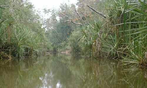
A typical Bera scene with its rich vegetations Some measurements - Tasek Bera is shallow lake with vegetation interspersed throughout its entire surface. So there is really, no big lake as city folks would imagine how a "Tasek" should look like. It is actually an alluvial peat swamp eco system. The wetland area measures 34.6 kilometers at its longest point and 25 kilometers at its broadest edge. At the limnetic region, the depth of water is about 2 meters deep and extending to 2.5 meters at the channels where water flows. The deepest part of the lake is at the main channel, at the outlet where a depth of about 7 meters had been measured. In the littoral region, depth is at an average of 0.8 meter.
During the annual cycle of wet and dry monsoons - the channel and its tributaries appear to pulsate as they swell with water. Water Source - Many tributaries from the eastern and western ranges encapsulating the Lake area, draining in water to charge the lake. Among them, the longest being the Serting River [west] and Bera River [east]. The volume of water brought in and its discharge into the Pahang River will maintain the level at the lake at its normal height.
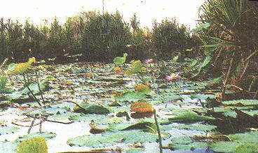
Flowers blooming make a spectacular view for travelers .
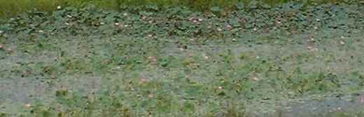
In the pockets of shallow water vegetations of all kinds thrives. The more commonly recognized are lilies. There several species of lilies, from the common pink lotus to the lesser seen multi-petal white lily. Then at the end of the year, during the Monsoon period, a phenomenon appears. There will be a reverse flow of flood water from the major river Sungei Pahang via Sungei Bera and through several channels into the lake region.
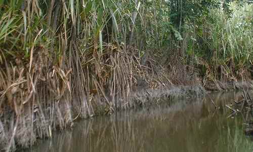
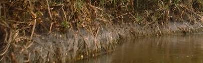
At that time, the water level in the lake is raised between 1 to 5 meters higher. Marks on the exposed roots along the bank bear testimony of the fluctuation in water level during the flooding season. Geographical orientation - This lake can be inversely thought of as an island of water surrounded by a sea of rain forest. Two very low but parallel mountain ranges [around 500 m high] flank Tasek Bera into existence within a corridor.
First Impressions You are expecting to find Tasek Bera as a lake - this scenic lake welcomes your arrival
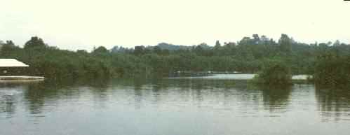
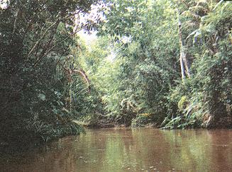
Through publicity, when you get yourself landed at the resort, then the lake looks idealistic. Open water and lush vegetations with hidden coves.
Here, this picture shows the scenery from the Personna Resort jetty.
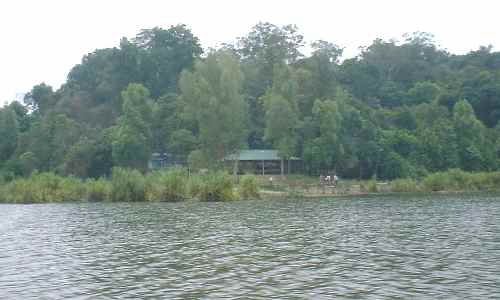
This is the choice spot on the northern side of the lake, where the flooded area bears some resemblance to that of a lake. Soon, you will find out that such scene is not representative of Bera.
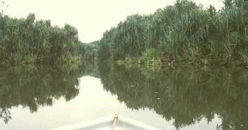
At the edges of the open water, seemingly endless number of canals transfer travelers to the next body of water. A natural maze unfolds before you.
Then there are other entry points. This picture shows a typical canal entrance that promises fun or mysteries. The moment the boat speed away into the unknown, civilization goes out of sight.
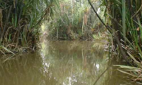
Gradually moving further inwards meeting the corners of the lake, the ecology is one of a sun-drenched belt of swamp rushes. The body of water is still hidden, concealed within the organically rich substrate.
In that boat ride, you may suddenly meet up with other landing points, like those in Pos Iskandar. In all canals, visitor continues to see the clear, benign central channel, with its open expanse of water ways. The landmarks are indistinguishable, while the waterways can be described as a maze.
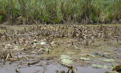
Most canals are fairly broad and deep, somehow tailored for 2 passing boats. There are also much debris, such as sunken tree trunk in the water brought down by the flowing water
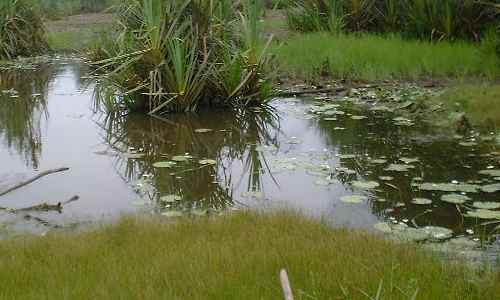
Away from the waterways with flowing water, there will be occasional pockets of independent ponds that holds lily plants Changing Scenes - There is the annual cycle of wet monsoons towards the end of the year. During the season of high water, the level changes the maze of channels into an open sea by drowning the fields of rushes.
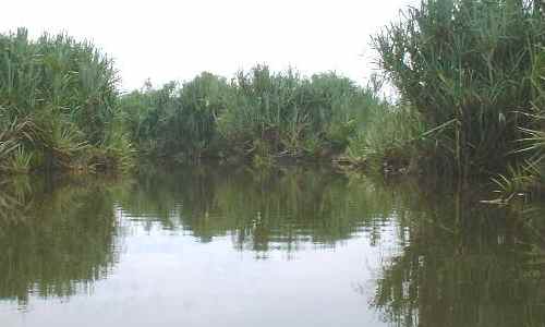
The channel and its tributaries appear to pulsate as they swell and drop with water, every time a stormy spell drops in and holds on for a few days. When the season is over, they then recede to the normal level and the spectacular Tasek Bera comes alive. This scenes you are now seeing is one from the dry spell. With its wide expanses of water, one can hardly detect a flow. No current can be seen. The phenomenon set forth a feeling that the water appears to rise directly from an invisible underground source.
After all that's being shown, a parting scene from that too familiar Pandanus Clump - synonymous with Tasek Bera |